Learn orienteering
Welcome! Let's learn more about orienteering.
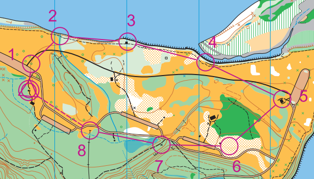
Example of a beginner course orienteering course, McIver State Park, Oregon
Orienteering is the competitive sport of land navigation. Using a highly detailed map, you choose a route between points marked on the map, and return to the finish line in the shortest amount of time. The route between each point is not specified, and the crafty and quick navigation decisions required are the essence of the sport. More advanced competitors usually run the course solo, while beginners often go out with a group. Either way, you complete the course at your own pace, and everyone gets the satisfaction of finding their own unique route.
You probably know a bit about about maps, hiking and/or trail running. Orienteering is a merging of these, and more. It's different, sort of Euro, maybe a little geeky, and unlike anything you've ever done before. We like to call it "hiking with your brain turned on." (Hiking and brain activation, two great activities!) You can do it if you're old or young, marathon runner or Sunday stroller. Most people who try it are hooked. Intrigued? Read on.
Beginners are welcome at all CROC events!
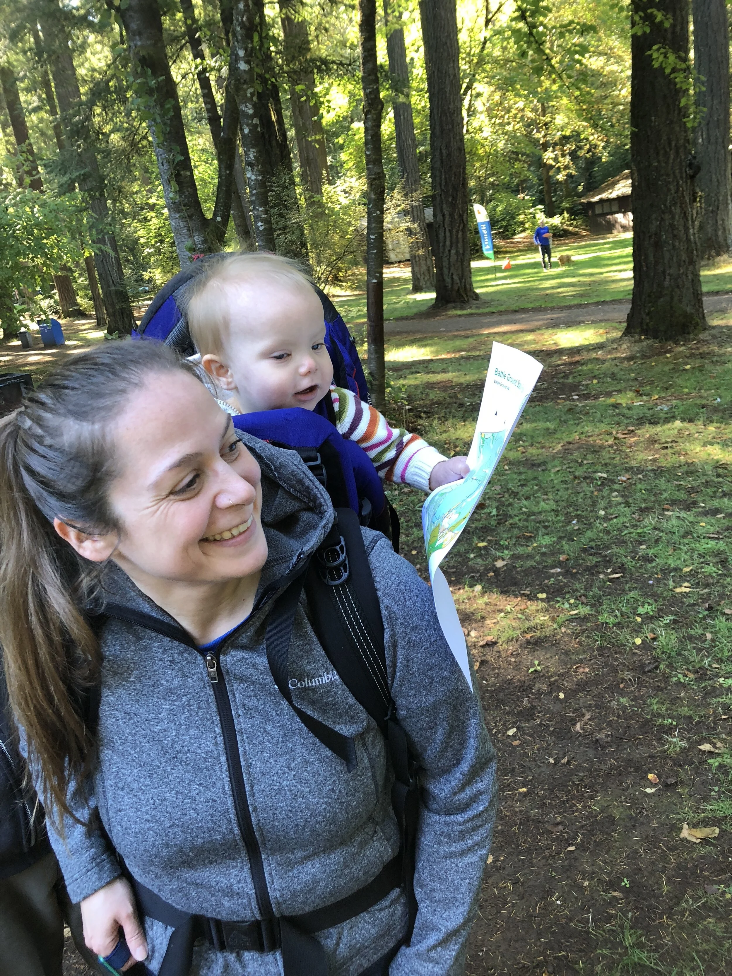
Orienteering can be done solo, or as part of a group, generally from 2 to 4 people. It’s a great social and team building sport.
We always teach free beginner clinics at our meets (about 10 minutes) so you can learn everything you need.
You do not have to be a CROC member to participate in a CROC event.
Orienteering can be enjoyed as either a casual stroll, or as a competitive running event, or any speed in between - your choice.
A compass is generally not required on beginner-intermediate courses.
CROC is a 501.c.3 non-profit corporation. All events are put on by volunteers. Event fees pay for permit costs, insurance, labor, supplies, printing and mapping new venues.
Orienteering - FAQ
I'm not a hardcore trail runner / my knee is dodgy / I have young kids. Can I still go orienteering?
Sure thing! Orienteering can be enjoyed as a cross-country run or a casual stroll in the park, your choice. We have many families at our meets, sometimes with kids in a backpack. While some participants are there to be competitive, most people simply want to enjoy seeing new trails, get some outside exercise, and use their navigation brain. Also, you can go on the course solo or as part of a family/group, your choice.
But I don't know how to use a compass…
No worries! While on harder courses using a compass might occasionally be helpful, easier courses are almost all map reading and very little compass use is needed. (If you'd like some additional compass instruction, ask one of the volunteers at a beginner clinic, or see our navigation instruction videos.)
What kind of clothing / gear do I need?
Generally, layered synthetic clothing appropriate for the weather is all you need. Standard running shoes usually work pretty well. Lightweight long pants are usually a good idea on the more intermediate or advanced courses, as it keeps your legs from getting chewed on by blackberries, stinging nettles and aggressive gophers. Bring a compass if you have one, but you probably won't use it much. A watch can be helpful. (Compasses are always available to rent if you need one.)
What’s a “Classic” event?
A “Classic” event is our term for one that offers standard point-to-point orienteering, with at least three levels of courses, typically beginner, intermediate and advanced. Some years, CROC has a series of Classic events at which you can earn points for your placement in each one. (Some of our events are called “special”; see more on that below.)
What types of orienteering are there?
There are two general styles of orienteering. On a standard course, participants go to each control point in a specific order: first control 1, then 2, then 3, etc. You can take as long as you need to, but you need to find every point, in order. (Don't skip any controls, or you'll get the dreaded "DNF, or Did Not Finish.") Think of this is the "left brain" style of orienteering.
For you right brain, creative people, we have another flavor of orienteering, called score-O. In score-O, you try to find as many control points as you can, in any order you like, within a fixed time limit. Only the top competitors have a chance at finding every control point in the time period, so the challenge becomes selecting a course that is most suitable for your fitness level.
Building on these, orienteering can be done with most any form of transport. CROC has offered what we term “Special” events, such as canoe/kayak-O, mountain bike-O, cross-country ski-O, night-O, and long-distance-O, also known as a Rogaine (6 to 24 hour endurance events). We're considering pogo stick orienteering, let us know what you think.
How do I get to the event?
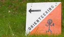
Our website has a Google map and driving directions for all of our events. Once you are close to the event area, look for signs like this to guide you to the registration area. (Note: while getting lost on the way to an orienteering event is considered slightly bad form, most of us have done it.) :-)
How long / difficult is the course?
Most of our meets offer at least three courses of varying difficulties. Call them beginner, intermediate and advanced. A beginner course is typically between 1 and 2 kilometers, is mostly flat, and has controls that are at easy to find locations such as trail junctions. As a beginner, you probably won't break much of a sweat, but you will get the general idea of how orienteering works. The exact details of the courses may be seen on the web page for a specific event.
Note: at the top of your clue sheet (see example below), you'll see a distance in kilometers. This is the straight-line, as the crow flies, shortest distance between all control points for your course. Because when actually navigating you have to go up, over, and around terrain features, your actual course distance will be longer than the distance shown your clue sheet. A rule of thumb is to translate kilometers to miles to determine the actual distance you will walk. For example, a course that’s 5 km on the clue sheet will translate into about 5 miles of real walking.
I’m a pretty serious runner and looking for a real workout. A 5 km course sounds too short. Can I get a longer run?
Good question. If you find that you still have some energy after trying a course, you’re welcome to go out on another course on a new map for free. If you string two or even three courses together, you may end up running between 10 and 15 miles total. (And, if you still have energy after that, we’ll probably ask you to go out and help pick up control flags after the event.)
Meters?! Kilometers?! What's with all this metric stuff?
Fun fact: The United States, Myanmar (Burma) and Liberia the only three countries in the world that do not use the metric system. Orienteering started in Europe. Ergo, orienteering is based on metric maps. Deal with it. You’ll learn to love it.
What happens when I arrive at a meet?
All of our events require online pre-registration. So hopefully you took care of this already.
When you arrive, you can take a beginner clinic if it's your first time. If you already know the drill, go over to the start area, where are you will get three important things:
A map. This shows you the terrain and the circled location of the control points, see above.
A control description (aka clue) sheet. This tells you specifically what you are looking for at each control point, see below.
An e-punch fingerstick. This is part of our electronic scoring and timing system, to confirm that you actually visited the control points.
Get your shoes on, have a drink of water, and when you're ready, go to the start area. Put your finger stick in the start control box, and off you go.
Please note that our orienteering events typically have a two hour window (usually 11:00 am to 1:00 pm) in which you can start. This makes it an ideal sport for those who like to sleep in on weekends, which, let's face it, is most of us. When you finish your course, be sure and check in at the finish table to record your time. Then you can eat cookies. Lots of them. You earned it.
What are the circles on the map?
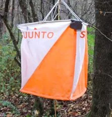
The numbered circles on the map are called “control points." Control points are distinct terrain features, such as a trail junction, boulder, building, etc. On the course, control points are marked with an orange and white flag that looks like a small box kite.
To prove that you visited the control point, we usually use an electronic scoring and timing system called “e-punch”. With e-punch, a small "finger stick" that you carry is inserted into a plastic box at each control point. The box transmits the control number and time onto your finger stick. At the finish line, this information is downloaded and your time recorded. Fingersticks are included in your registration fee, or you can use your own and get a discount. For complete details on epunch, see "All About Epunch" under our “Get Better” page.
Can I see some examples of orienteering maps?
Sure thing! CROC posts maps of most all of our previous events from 2012 onward on our website under Getting Better > Event Maps
These maps look different than the ones I use for hiking. What's special about an orienteering map?
Orienteering maps are different in several main ways. One, they are at a larger scale (or more zoomed in) to show tiny map details such as individual trees, boulders, and other small things you would normally not see on a topographic map. Two, the colors show vegetation density, with various shades of green meaning vegetation you usually don't want to try to run through, and shades of orange or white showing easier terrain. (More on this below.) Three, orienteering maps are usually drawn to magnetic north, not to true north.
Okay, I understand what a map is. But what's this control description stuff?
A control description, also known as a clue sheet, tells you more specifically what you're looking for. For example, the map simply shows you a circle with a control number "1" next to it. But the clue sheet tells you that control number 1 is marked with a number 31, and it's a lone conifer tree. When you're on the course, you may find control points that are quite close together. The clue sheet confirms you are at the right place. Here's an example of a clue sheet from one of our meets.

Hmmm. Why is control number 1 marked with a goofy number like 31? Why isn’t it marked control number 1?
Great question. The answer: Keep in mind that at any given event, we have multiple courses set up. We often use the same control for several different courses. For example, control number 1 on the beginner course might be control number 5 on the intermediate course. Having a specific number marking each control, such as 31, tells each participant regardless of their course, that they are at the correct control.
What's with the hieroglyphics on the clue sheet?
Ahh, we're glad you asked. Orienteering first started in ancient Egypt, at the time of the 11th Dynasty, about 2100 BC. (Just kidding. It was actually Scandinavia, about 100 years ago.)
It’s because orienteering is an international sport. A large international O-meet will have participants from many different countries speaking many different languages. A common “language” of orienteering symbols allows everyone to compete equally. By learning these symbols early in your orienteering career, you will thank us when you someday go to the world championships in, say Latvia, and you realize that you do not know the Latvian words for "vegetation boundary". On beginner courses, we always try to have both the control symbol and the plain text description on the clue sheet.
I see magenta colored lines drawn on a straight line between the circles. Is that the route I need to follow?
No, it's not. Unless you're a hummingbird. The lines between control circles, as shown the map above, are there to show you at a glance the sequence of controls. The magenta lines are not the route that you should or need to follow.
What's with the colors on the map?
The map colors are meant to show the vegetation density. In orienteering, a constant question to answer is: "Can I run through it, or do I need to run around it?" Orange and white indicate open grass and more open runnable forest. Shades of green, from light to dark, indicate increasingly dense vegetation, blackberries, stinging nettle, and aggressive gophers. If you see green on your map, you probably need to look for a trail to get through it. If you see orange or white, you can usually move on more or less a straight line.
Here's a link to a more comprehensive map legend that shows everything you'll ever find on an O-map.
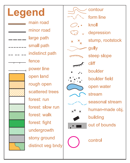
Legend from a CROC orienteering map.
Can I bring my dog?
Dogs are generally allowed at orienteering meets. Of course, any existing rules of the event venue, such as a state park, must be followed. Bonus points for you if you can train your hound to sniff out orange and white orienteering flags. (Sorry, but we don't rub raw meat on the control flags before we set them out.)
Can I bring my friend(s)?
Absolutely! Orienteering is a wonderful sport for a small group. It's also excellent for couples therapy, as any two partners who can make it through an orienteering course without strangling one another are destined for a long and happy life together. Typically, we recommend a group size from 2 to 4. Additional maps may be purchased at the start of the event for the extra people on your team. A discounted rate is offered for groups.
Can CROC teach me to use a compass, or teach my group a private orienteering lesson?
Answer, maybe. We are fairly small nonprofit club with limited member resources, and we are not able to answer all requests for instruction. However, we have two good places to start. One, we usually offer free beginner clinics at all of our events, so you or your group can just show up and we'll get you started. Two, we have a series of instructional navigation videos on our YouTube channel, and posted here on our website under Get Better > Navigation Videos. This video series covers map reading and compass use for wilderness navigation, with much of it applicable to orienteering.
How can I start an online discussion with other CROC orienteers?
We have an easy to join email list. Use it to find a ride to an event, share a training tip, post photos, and communicate online with most CROC members.
Do you cancel if it's raining?
Come on, are you kidding? What, are you from Arizona or something? This is the Pacific Northwest, and rain never precludes outdoor fun. CROC events are held rain or shine. We will (rarely) cancel an event due to unsafe travel conditions such as: ice, heavy snow, and/or aggressive gophers.
Why do some orienteers wear goofy clothing?
Orienteering evolved as a sport in Scandinavia, a region generally not known for a highly developed sense of fashion. The "polyester pajamas” uniforms sometimes worn by Europeans, typically in bright and hideously clashing colors, are useful in several ways: avoiding scratches from thick vegetation, showing pride in your local club, and helping helicopter search and rescue spot them more easily after they get hopelessly lost.
You call this a FAQ? You boneheads didn't answer my questions. I've got more.
No worries! Shoot us an email and we'll be glad to answer them.