
Event overview
Hamilton Island (approx 35 miles east of Portland ) lies along the Washington shoreline of the Columbia River, upstream of Beacon Rock, and downstream of Bonneville Dam near Cascade Locks. Hamilton Island used to be an island; however, it is now a peninsula. In the 1970s the upper part of "Hamilton Slough", bordering the northeast side of Hamilton Island, was filled in with debris from the construction of Bonneville's North Powerhouse. The lower part of Hamilton Slough became part of Hamilton Creek, which borders the west and northwest side of Hamilton Island. On the southeast and south is the Columbia River.
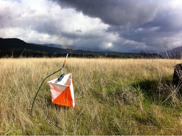
The terrain is mostly wide open with scattered copses, and you can run. There is one large low hill to go around or climb multiple times!!! There are marshy areas, some thickets, and shorelines. You can enjoy beautiful river gorge views.
Times
- Registration 10:30 am - 12:45 pm
- Beginner Instruction Clinics 11:00 am - 1:00 pm as needed
- Intermediate Workshop: 10:00 a.m - 10:45 a.m. (details below)
- Course starts 11:00 am - 1:00 pm
- Courses close 3:00 pm
All teams must check out through the course finish gate before leaving the park, even if the team does not finish the course or returns after the course closes.
Intermediate skills workshop - Map and Control symbols
We’ll learn those funny symbols on the control description sheet and how they help you locate the control. We’ll also link them to the symbols on the map. Intermediate workshops are for people who want to up their skills beyond the Experienced Beginner level. Meet at the registration area at 10:00; no additional fee for the workshop. It will last about 45 minutes.
Courses
- Beginner (about 2.5 Km, 11 controls, simple navigation, one easy climb, on-trail and near-trail navigation)
- Intermediate (about 3.7 Km, 13 controls, some hill climbing, on-trail and near-trail navigation)
- Technical (about 4.9 Km, 14 controls, route choices, moderate climbs, many off- trail controls)
- Advanced (about 7.0 Km, 17 controls, some long legs, complicated route choices, opportunities to run, elevation gain and mostly off-trail navigation)
Electronic scoring (e-punch) will be used on all courses. Each participant or team receives a course map and a control description sheet. All participants must register and sign the liability waiver before entering the course. Learn more about e-punch here.
Fees for this event are:
- $17 - individual (non-member)
- +$5 - any additional persons in your group
- kids ages 9 and under are free
- youth groups / scout groups: $10 per team
- subtract $5 for CROC members
- subtract $5 for using your own epunch
Payment is by cash or check only.
Become a CROC member - Buy your own epunch
Maps
See a map of a previous event here.
Volunteers
All CROC orienteering events are put on by volunteers, and the meet director can almost always used some extra hands. Please keep in mind:
- No prior experience is needed for many of the tasks
- You can help out AND still run your course of choice
- Your entry fee is FREE if you help out with a meet!
Typical ways to assist are: helping with starts and finishes, checking in folks at registration, and picking up control flags after the course closes.
Please contact the meet director at the email address on the bottom of this page if you'd like to volunteer at this event. For more details, see the Volunteer pages.
Results
Results are posted to the Events & Results web page a few days after the event.
Contact
Meet director Jill and Rick McBee
Driving directions and map to event
Note the event site this year is in North Bonneville, not at the 2017 location. Note also there will NOT be a CROC sign on Hwy 14, as the locals like to (ahem) remove them.
Latitude longitude coordinates of event: 45.6338, -121.9790
Copy and paste these latitude longitude coordinates (in decimal degree format) into Google maps or your smart phone to get a map and driving directions to the event.
Driving directions from Portland:
- Exit I 84 at Cascade Locks
- Cross the Bridge of the Gods into Washington (Toll $2)
- Turn left (west) onto Hwy 14 and go approx. 4 miles
- Turn left onto Bonneville Road – signposted North Bonneville, turn at the Chevron gas station.
- Immediately turn right onto W Cascade Drive and go approx 1/2 mile through North Bonneville village. Follow the signs to "ball field"
- Turn left onto Portage Drive and go about 1/4 mile farther. Park in the baseball field parking lot.